National Weather Service provides update on Hurricane Harvey
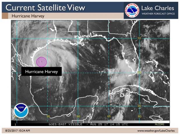
The National Weather Service in Lake Charles is still monitoring Hurricane Harvey, expected to be a category 3 or 4 hurricane when it makes landfall on the central Texas coast Saturday morning.
Harvey will weaken to a tropical storm on Sunday, before slowly moving up the upper Texas coast early next week. It is too early to know for sure if it will move offshore, or stay inland as it moves up the Texas coast next week.
Heavy rain and flooding will be the most significant impact. Southeast Texas is expecting 10 to 20 inches of rain, southwest Louisiana 8 to 15 inches, central Louisiana 5 to 7 inches, and south central Louisiana 7 to 10 inches. Some of this rain is already beginning in southeast Texas and parts of southwest Louisiana today.
Due to the rains, major river flooding is expected. Pine Island Bayou near Sour Lake, and the Calcasieu River near Old Town Bay and Sam Houston State Park. Other river forecast points could be included as we go through this event.
Storm surge values of 1 to 3 feet above ground level are expected in southeast Texas and southwest Louisiana, and 1 to 2 feet above ground level in south central Louisiana. High tides will occur around 6:30 p.m. and 6:30 a.m., so expect to see the highest water levels during high tides. This could continue through the entire weekend.
Winds will be from the east, gusting 25 to 25 mph along the coast tonight through Sunday night. This could be extended as well, depending on the track of Harvey next week.
The tornado threat is increasing for today and Saturday in southeast Texas and southwest Louisiana as rain bands move onshore across the region.